
The firm has worked with top transportation figures in Montreal and Quebec.
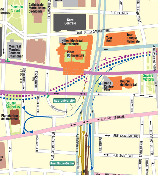
Centre-Ville Map
The firm’s first Canadian map was of Downtown Montreal, untangling the complex over and under interconnections between the central expressways and the local street grid, including one interchange which official maps and consumer maps alike had gotten wrong (or missed completely). It also untangled the local street gird, serving to highlight business district densities and attractions.
Client: Informing Design
Time Frame: 2005 to present

Montreal Island Trucking Map
The firm then went on to remap the entire island of Montreal for trucking use, using shaded “islands” to indicate no-go zones for trucks.
Client: Group SMG
Time Frame: 2006 - 2008