Informing Design has been at work on state-wide projects for the Maryland State Highway Administration since 2001.

Highway Sign System Development
Bob Firth, founder of Informing Design, first presented his mapping tool as one of three speakers invited to a specially assembled symposium on “Getting Lost” at the National Academy of Sciences in Washington in 1996. It was there that he met one of the leading state highway officials in the country, Tom Hicks, then head of the Office of Traffic and Safety at the Maryland State Highway Administration. By 2001, Bob was tasked with developing a whole new kind of tourism-oriented sign system based on his concepts.
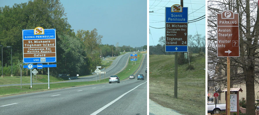
Tourist Area and Corridor Sign System
Based on guidelines developed by Informing Design, the Maryland State Highway Administration embarked on a massive new sign system, replacing all current Tourism-related state signing. Based on Bob’s “aggregate effect mapping” tool, the Tourism Area and Corridor (TAC) Sign System creates routes to tourist areas, then along area-spanning corridors to reach qualified attractions, with relatively few attraction-specific signs required. Such signs are needed only starting from the last turn off of the defined corridor.
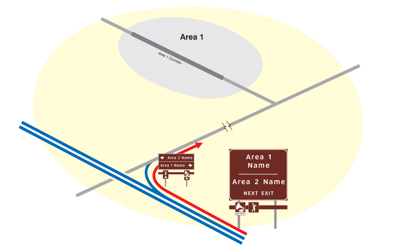
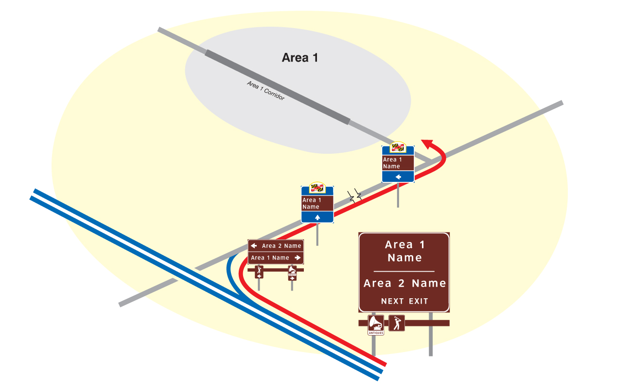
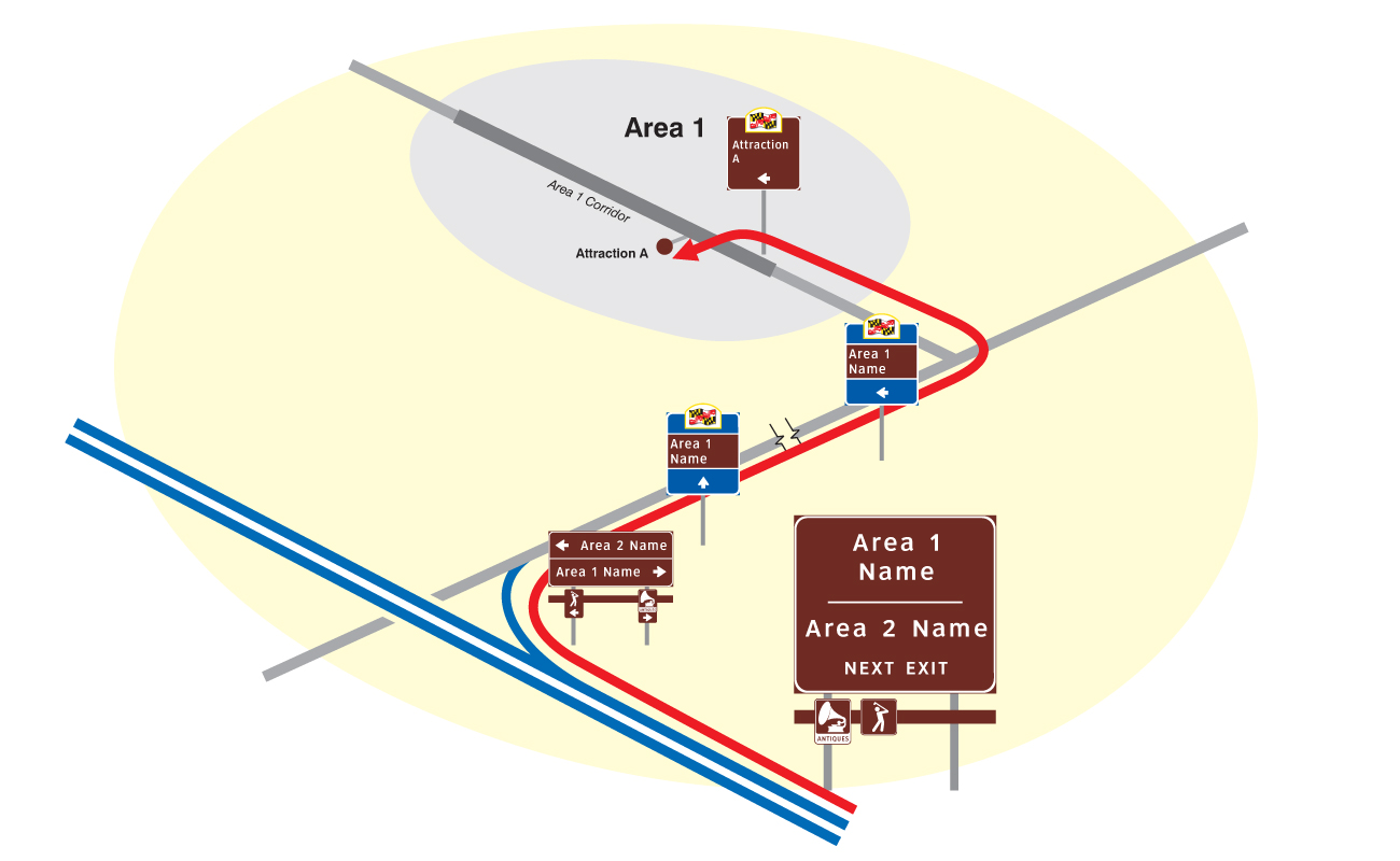
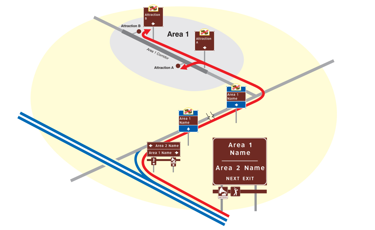
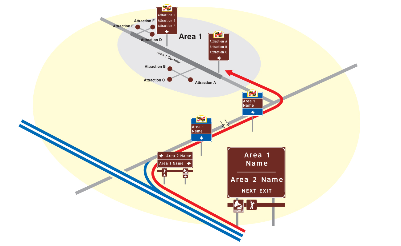
This hierarchical routing system was developed in response to an explosion in attraction-specific signing and as an alternative to the FHWA TODS system (Tourist-oriented Directional Signs), which only has one type of sign – attraction-specific ones — and allows those signs to run for many miles from a state highway. Because of the way it is organized, TAC not only highlights the names of tourist areas much more effectively and prominently, starting from interstates, but it also allows for all attractions in an area to benefit from guidance without unsightly sign clutter and information overload. Moreover, TAC also works in cities and towns by directing motorists to parking facilities by the groups of attractions they serve, something TODS cannot do.
Client: Maryland State Highway Administration
Time Frame: 2001 to present

Airport Sign System
The firm designed the traffic sign system for the Thurgood Marshall BWI Airport as well as sign systems for the entire region of hotels and business parks around the airport. A new feature was the creation of an “Airport Loop” which greatly simplified guidance and reduced the need for signing, as motorists followed the simple loop markers to carry them from one destination zone to another.
Client: Maryland State Highway Administration
Time Frame: 2001, currently in use
Pedestrian Map Kiosks
For historic Cambridge on the Lower Eastern Shore of the Chesapeake Bay, the firm developed new pedestrian maps and deployed them in its “Personal Map Station” format. (See “A Less Embarrassing Map Kiosk” case study.) The area around Cambridge was mapped at a farther out zoom, and provided as an insert in a corner of the main map. Interpretive illustrations were provided on the borders.
Client: City of Cambridge, Maryland
Time Frame: 2010